Friday, October 9, 2015
Jackson Bottom Wetlands
The most beautiful place in my own habitat is Jackson Bottom Wetlands. The natural area never fails to inspire.
Wednesday, June 24, 2015
Steens Mountain
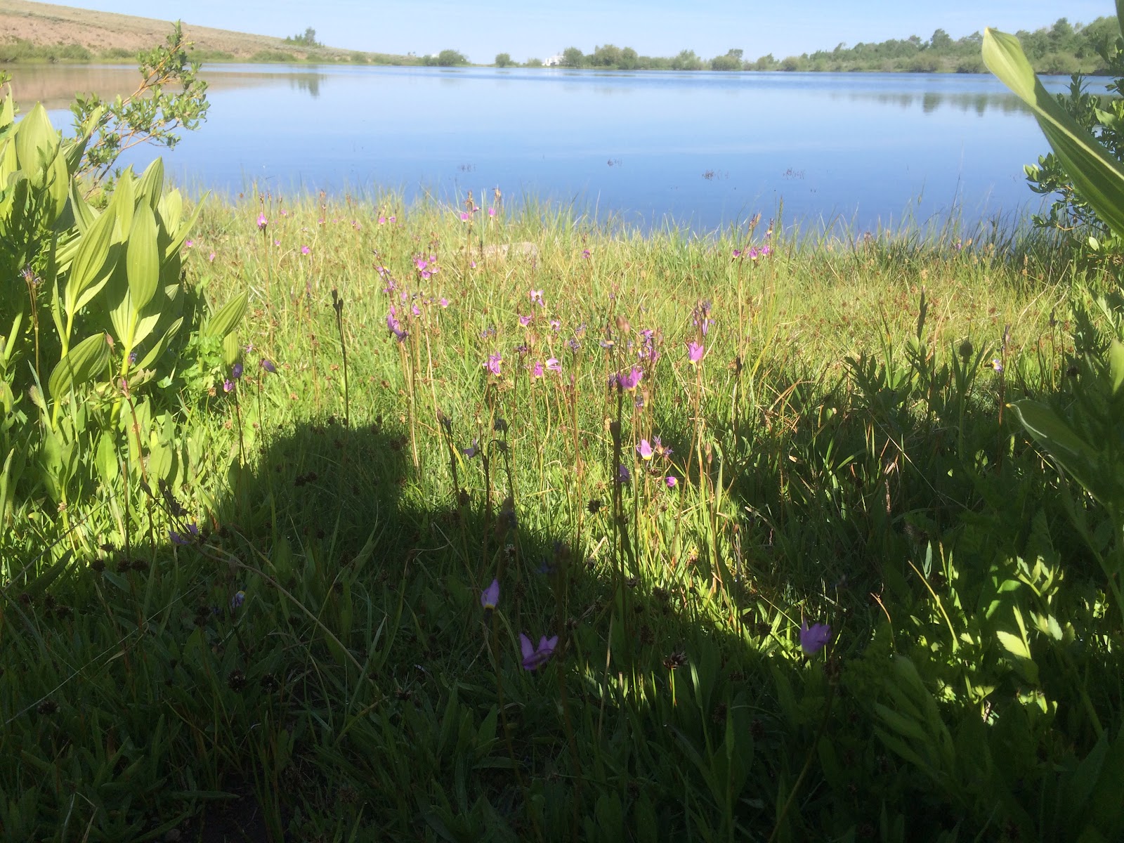
We traveled to the Steens Mountain mid-June. Our first plan was to camp at Paige Springs, but the mosquitoes were rampant. We ended up camping at Fish Lake on the mountain. At Fish Lake, the mosquitoes were about a week behind Paige Springs and the temperature was about 10 degrees Fahrenheit cooler. The wildflowers were out in full force.
The gate at Jackman Park was opened the day we arrived. We are able to drive to the top and see Wildhorse Lake, the Alvord Desert, and Keiger Gorge.
We did very little hiking, but the boys swam and fished in Fish Lake. We also visited Fields and Diamond.
Tuesday, March 31, 2015
Fort Rock
Fort Rock is a highly accessible and beautiful rock formation the middle of high desert country. The volcanic formation sits to the northwest of Christmas Valley. The formation is designated a natural area and is managed as a state park. You can visit dawn to dusk. There is a restroom, some picnic tables and a park host.
The park is surrounded by hay farms, and, hence, a variety of ground squirrels, jack-rabbits and other small mammals. The rodent population attracts large birds of prey - some of whom nest at Fort Rock. We spotted a newly deceased Great Horned Owl below what appeared to be a cliff-side nest. Perches have been added to electrical poles in the area. Along the highway, we spotted a bald eagle, golden eagle, and a ferruginous hawk.Circling close to Fort Rock were prairie falcons, vultures, and raven.
The entire rock formation can be hiked within a few hours. There were several highlights for us. We enjoyed yelling across the formation and hearing our voices echo back. The rock itself is pretty interesting - with a variety of vesicles forming patterns in different section of rock. If you walk close to the rock, it is possible to find several locations where owls drop pellets and thousands of small bones. Walking to the top of Fort Rock, you will be able to peer over the sheer outer rock face. The rock itself has a hollow sound to it when you knock on it.
On our hike, we spotted a few lizards, birds, and jack-rabbits. It also looks like prime rattlesnake habitat.
If you want to camp in the area, north of Fort Rock about five miles is the Cabin Creek Campground - a rough camping area. The campground offers a beautiful Ponderosa pine forest - but not water or toilets. At the south side of the campground are some Forest Service buildings and two bird blinds. We spotted nut-hatches, nutcrackers, mountain bluebirds, and chickadees. We also heard flickers. The mammal population seemed hopping - lots signs (tracks, scat and sound) of deer, elk, coyotes and bobcat. We did not see any mammals, though.
Thursday, May 8, 2014
Sunstone Mining - the Sequel
In March, we headed back to the Dust Devil Mine to see if what we could dig up. This time, we brought one of my son's grandmothers...and lunch. We were prepared to give our son as much time as he wanted to find as many sunstones as he could.
Unfortunately, in the spring, the mine does not supply tools. My husband had a maul in his car toolbox, and this kept my son busy for quite a while. Grandma and I worked with shovels and a shaker table. We found quite a few stones. My son, however, had was determined to dissect a 24-inch diameter boulder. He could see a large stone on one face.
Henry worked on this for about an hour when the man who was watching over the facility showed up and began to give him some good advice on how to delicately pull the boulder apart. He also retrieved his five-pound hammer and the chisel from a jackhammer. The boulder was pretty quickly reduced to many smaller rocks.
By the time the boulder was apart, Henry had a bucket full of specimens (rocks with sunstones not yet removed) and sunstones. Some of the sunstones were fairly large. We spent quite a bit for the stones (more than the market value), but it was worth the expense for the experience.
I asked Henry this morning if there was any sort of an adventure he would like to go on this summer. He wants to return to the sunstone mine.
Friday, April 11, 2014
Hiking the hills in Lakeview
Lakeview, Oregon is a small town (~2,500 residents) in the south, central part of the state. It sits at a mile in elevation and is high desert. From the hills in Lakeview, you can see Goose Lake straddling the border of Oregon and California.
Every decade, high school students repaint the letter 'L' in the hill-side near town. The hike to the 'L' is steep and fairly rocky but short (~ 0.5-1 mile each way). It is a great opportunity to spot deer and wildflowers (in the spring).
This year, our hikes in the hills were unique in the view of the shockingly low water level of Goose Lake (in March). Everywhere we went, people in the area had something to say about the drought. It will be a tough year for cattle as well as the native animals and migrating birds.
Thursday, April 10, 2014
Crack In the Ground
Crack in
the Ground is a geological site in Christmas Valley, Oregon. It is a two-mile long rock-lined crack in the
ground (up to 70 feet deep and 10 feet wide).
It is possible to hike in the bottom of a short section of the crack
with limited bouldering.
We walked in the bottom of the crack and returned by walking
on the top. The canyon itself s interesting – the walls on one side of the crack
are smooth and weathered with rounded surfaces. The other side has sharp edges
and rock planes. The Wikipedia site on this location indicates that Crack in the Ground
is a volcanic fissure. It is believed to be fairly new – only ~1,000 years old.
The most interesting part about the location was the
top-side return hike. First, it would be possible to be on horse-back in this
area and fall right into either the main crack or one of the tributaries. There is no real indication that at crack
exists as you make a perpendicular approach.
We also observed a large nest sitting on the top of one of the
larger rock surfaces in the crack with three tan eggs. It might have been an
owl’s nest that had been abandoned. Cliff swallows were also present.
This is an easy hike and the overall visit could last from 1
– 2 hours. We were pretty hungry and headed into Paisley for a late lunch.
Friday, March 28, 2014
Derrick Cave – Fort Rock, Oregon
Derrick
Cave is a large lava tube, located in south-central Oregon. The cave is
best accessed from the north. Original access was described as part of the BLM’s
Back Country Byway. However, this route requires crossing private land. The current
landowners appear to have had enough bad experiences with people not
understanding how to drive on rocky, gravel roads. Signs posted at the start of
their property warn that there is no longer access to Derrick Cave from the
south. A good forest service map of the Newberry
National Monument will lead you to the cave.
Derrick Cave is unique in both its size (30-foot diameter)
and use as a nuclear fall-out shelter during the Cold War. At one time, the
cave was outfitted to provide food and water for approximately 1,200 people.
Our visit to Derrick Cave was the first ‘caving’ experience
for me and my son. It was a great way to start our caving adventures. The cave
is big enough that we were able to stand throughout. The hiking involved a bit
of scrabbling across boulders. The biggest adjustment was hiking in the dark.
We had some fun with periodically turning all of our lights off.
We brought a few head lamps, flashlights and our usual first
aid kit and water. We spent about an hour hiking into and out of the cave.
Because it was spring, the outside temperature was not much different from the interior
of the cave. However, in the summer, the temperature difference would be large.
There are ice formations in the cave. There was also quite a bit of dust. The
surfaces of the rocks are abrasive – so long sleeves, gloves and good shoes
(i.e. not flip-flops) are a good idea. I walked out with torn gloves, but my
running shoes were fine.
Subscribe to:
Posts (Atom)